
Background
IN1207 | |
EGRIP Field Station | |
Arctic | |
Open | |
Station | |
Greenland | |
Station | |
2015 | |
May; June; July; August |
Introduction
EGRIP (East Greenland Ice Core Project) Field Station owned by Centre for Ice and Climate, Niels Bohr Institute, University of Copenhagen, Denmark. | |
The station is located on the North East Greenland Ice Sheet (75°38’ N, 36°00’ W, 2704 m a.s.l.) within the North East Greenland National Park. The scientific reference area is a 50 by 50 km square with the station in the centre. The station is on the centre axis of the North East Greenland Ice Stream (NEGIS), 480 km from Danmarkshavn, 690 km from Ittoqqortoormiit and 350 km NNE of Summit Station. Due to its location in the ice stream, the station moves 50 m NNE per year. | |
Landscape is flat and white with only slight variations in altitude in the vicinity of the station. The annual average temperature is around -28 °C and annual snowfall is around 100 mm water equivalent. Temperatures above 0 °C are extremely rare. Birds (geese, seagulls and finches) are the only observed life forms migrating across the Ice Cap. | |
The station was established in 2015 when the former NEEM ice core drilling station was towed by tractor 465 km to EGRIP. The station has a capacity for 25 (peak 40) residents and there is a doctor, a cook and mechanics on site. The station facilities include kitchen, dining area, bath room, laundry, lounge, electronics workshop, office space with internet, sickbay and flight operations office, carpenters workshop, mechanics workshop and storage. Vehicles at the station include tracked vehicles, snowmobiles and snow throwers. There is also an underground drilling and science area with snow caves and connecting tunnels. Access to underground areas is by elevators and stairs. | |
Main research fields are deep ice coring and ice core analysis. Studies of processes at the base of the ice stream and of surface snow composition are also conducted at the station together with weather observations and studies using airborne radar, GPS network, seismic sensors and other geophysical methods. Data and detailed information will be made available on www. iceandclimate.dk. | |
Nearest human habitation is Danmarkshavn (weather station – 480 km away). Nearest settlement is Ittoqqortoormiit (690 km away). | |
The station is accessible by ski equipped aeroplanes only. The station features a 60 m wide and 3.6 km long marked skiway with a 3.6 km marked lead in each end. Fuel is stored in 3 × 15,000 liter steel fuel tanks with an air craft fuel pump with 1000 liter per minute capacity. Flight time from Kangerlussuaq 2.5 hr by LC-130, 5.5 hr by Twin Otter or 4.5 hr by Basler |
Operator
University of Copenhagen, Denmark | |
Government | |
Centre for Ice and Climate, Niels Bohr Institute | |
jps@nbi.ku.dk, lbl@nbi.ku.dk |
Data Source
Partner Institution
Yes | |
Alfred Wegener Institute, Bremerhaven | |
National Institute for Polar Research, NIPR, Tokyo | |
Japan | |
Bjerknes Centret, Bergen | |
Norway |
Location
IN1207 | |
75° 38' 0'' N | |
36° 0' 0'' W | |
North America Arctic | |
2708 | |
2600 | |
2800 | |
690 | |
720 | |
480 | |
350 | |
Ice-sheet |
Climate
Continuous | |
High Arctic | |
Snow | |
100 | |
21.6 | |
60 | |
SW | |
01/May/13 to 16/06/16 | |
-29 | |
-50 | |
-10 | |
None |
Features
Ice cap or glacier; Permanent snowpatches |
Disciplines
Atmospheric chemistry and physics; Climatology; Climate change; Ecology; Environmental sciences; Geocryology; Geodesy; Geomorphology; Geophysics and seismology; GIS; Glaciology; Hydrology; Isotopic chemistry; Mapping; Paleoecology; Pollution |
Human Activities
Yes | |
Yes | |
Yes | |
Yes | |
Yes |
Infrastructure
IN1207 | |
750 | |
350 | |
Other | |
Ice core processing laboratory | |
20 | |
200 | |
42 | |
Yes | |
Yes | |
Fossil fuel | |
230 | |
24 |
Staff Capacity
5 | |
20 | |
0 | |
0 | |
30 | |
0 |
Scientific Equipment
Ice core processing equipment | |
Processing, packing and shipment of snow and ice samples | |
Automatic weatherstation, seismometer, snow height, snow density, surface velocity, ice flow pattern (GPS strain net) |
Medical Facilities
Yes | |
10 | |
Medical doctor | |
0 | |
Altitude sickness compression bag (Gamow) | |
1200 | |
1 | |
0 | |
0 | |
0 | |
VHF radio, Personal Locator Beacon (PLB), Full polar clothing, tent, sleeping bag | |
First aid equipment, satellite phone, rations, fuel, stove | |
No | |
Yes |
Vehicles
4 snow mobiles, 2 Kaesbohrer Pistenbully (PB 300 Polar), 2 Kaesbohrer Flexmobiles |
Workshop facilities
ICTS (Staff available to assit with constructions) |
Communications
Computer; E-mail; Fax; Internet; Printer; Satellite phone; Scanner; VHF |
Access
IN1207 | |
Air |
Aircraft landing facilities
1 | |
3600 | |
61 | |
Airstrip (Skiway) marked and maintained according to requirements for landing with ski-equipped Hercules planes | |
Yes |
Transport and freight
Airplane | |
0 | |
20 | |
May; June; July; August |
Access To The Facility
Yes | |
Yes | |
KNNO (exp@nanoq.gl) |
Pictures
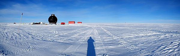 EGRIP CAMP(Credits: Jørgen Peder Steffensen) |
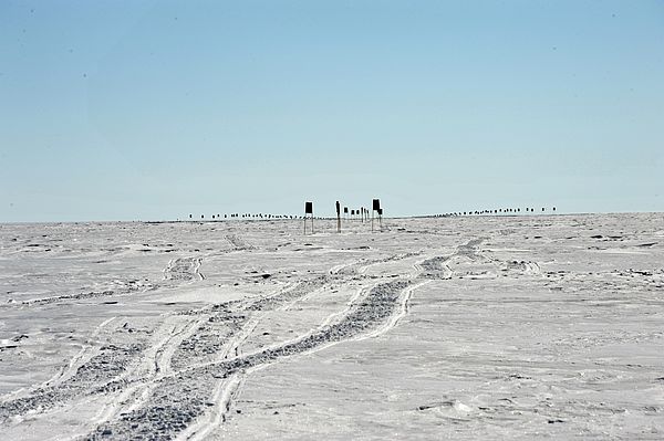
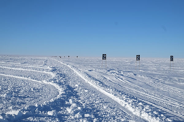 Skiway (Credits: Jørgen Peder Steffensen) |
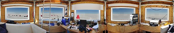 Main dome3 (Credits: Jørgen Peder Steffensen) |
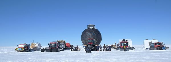 Arrival of EGRIP (Credits: Dorthe Dahl-Jensen) |
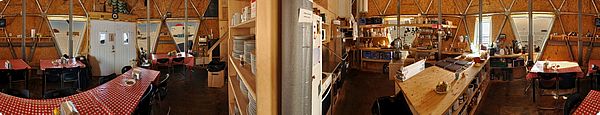 Main dome (Credits: Jørgen Peder Steffensen) |
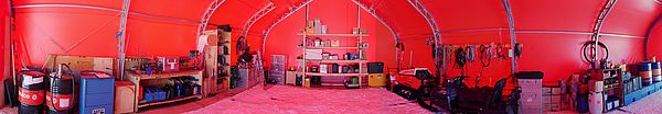 Mechanical garage (Credits: Jørgen Peder Steffensen) |
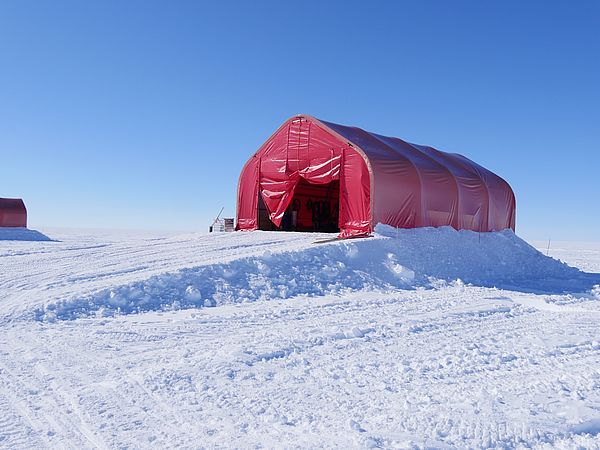 Garage outside (Credits: Jørgen Peder Steffensen) |
 Skiway (Credits: Sepp Kipfstuhl) |
 CAMP2 (Credits: Jørgen Peder Steffensen) |