BAS polar research aircraft fleet and associated infrastructures
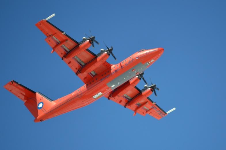
The British Antarctic Survey operates 5 research aircraft: 4 Twin Otters and a Dash 7.
Twin Otter | Dash 7 | |
Aircraft Registrations | VP-FAZ, VP-FBB, VP-FBC, VP-FBL | VP-FBQ |
Range | 1,000km | >2,000km |
Cruise Speed | 65m/s (130 knots with skis, 150kt clean) | 120m/s (230kts) |
Survey Speed | 60m/s | 110m/s |
Crew | 1 Pilot (dependant on role) | 2 Pilots |
Mission scientists (max) | 4 | 4 |
Fuel Consumption (planning) | 330l/hour | 630l/hour |
Max Take Off weight | 6,360kg (14,000lb) | 21,300kg (47,000lb) |
Survey power available | 300A (28V) | 300A (28V) |
The type of science supported
The aircraft have supported research monitoring and recording interactions between the Earth’s crust, ice- and snow-covered areas, oceans and the atmosphere. This is both from a logistics perspective in deploying instruments and field camps but also as airborne research platforms.
Mapping of the Earth’s magnetic and gravity field, ice thickness & structure, sea ice thickness, snow thickness on sea ice, surface morphology/altimetry
Measuring in-situ and remotely aerosols and trace gases
Measuring temperatures, humidity, wind distribution
Radiation measurements
Optical remote sensing
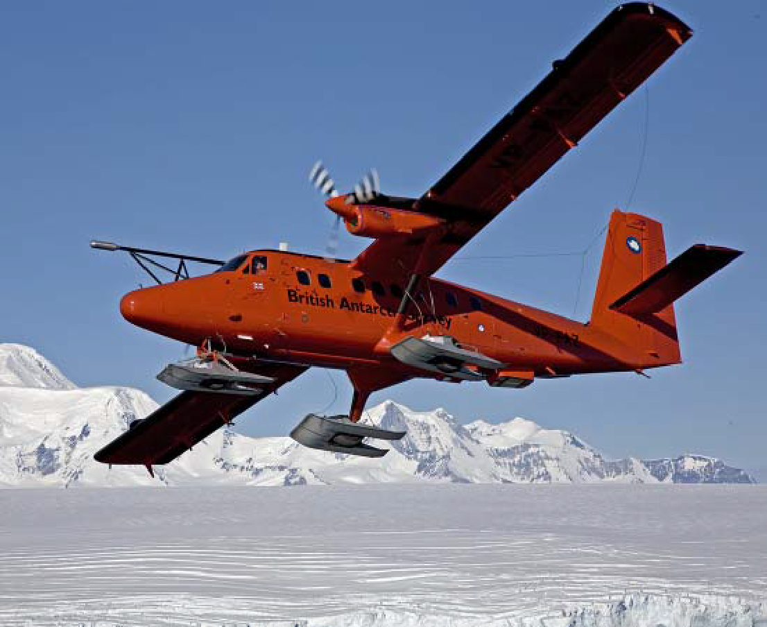
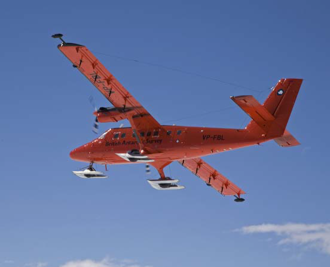
Twin Otter
Four aircraft of the DHC 6 300 series with STOL capabilities. They can operate from paved and unpaved surfaces. All four can undertake polar logistics support including to sea-ice camps. They can be equipped with wheel skis and have extended range tanks fitted. Two aircraft are modified to support airborne and remote sensing applications.
Airborne Atmospheric Research Capabilities of the Twin Otter (VP-FAZ)
Instrumentation for Atmospheric Research:
Total Temperature | Goodrich Rosemount Probes mounted on the nose. A non-de-iced model 102E4AL and a de-iced model 102AU1AG logged at 0.7Hz. |
Altitude and Position | GPS NMEA and one pulse per second (1pps) is distributed to all systems to provide synchronisation of all the data and formation of coherent data sets. |
Air Speed | Static and dynamic pressure from the aircraft static ports and heated pitot tube, logged using Honeywell HPA sensors at 5Hz. |
Cooled-Mirror Hygrometer | A Buck 1011C cooled mirror hygrometer is fitted. Chamber pressure and mirror temperature are recorded at 1Hz. A Rosemount mounted Vaisala Humicap sensor is also logged. |
Radiometers | Eppley PIR and PSP sensors fitted to the roof and underside of the aircraft. Logged at around 10Hz. |
Infra-red Thermometer | Heimann model KT19.82 infra-red thermometer mounted in the floor hatch panel. There is a solenoid operated, ambient temperature, black-body calibration target that can be brought into view during flight. Data are recorded at around 10Hz. |
Laser Altimeter | A Riegl LD90-3800VHS-FLP Laser Altimeter is fitted in the floor hatch. Returns up to a few hundred metres are possible depending on the surface at repetition frequencies up to 2kHz. |
Cameras | Two Sony DV-tape cameras can be used. One downwards-looking mounted in the camera hatch, one forward-looking mounted in the cockpit. A Canon EOS7D with 15mm lens can be triggered to take 18MP images at up to 1 frame/sec. |
Laser Scanner | A Riegl Q240 80 degree laser scanner has been used for mapping sea ice. |
Radar Altimeters | Data are recorded from the aircraft’s two radar altimeters at around 10Hz. These have a range of 1000m with a wider beam compared to the laser altimeter. |
Turbulence Probe | A NOAA/ARA BAT 'Best Aircraft Turbulence' probe is fitted on a boom extending forward from the roof of the aircraft. This 9-hole probe records pressures and exposed thermocouple temperatures for measuring turbulence by eddy covariance in conjunction with attitude measurements. Three-axis accelerometer data are also recorded from the BAT probe. Heaters are fitted inside the hemisphere to enable the instrument to be usable even after encountering icing. |
GPS Position | Around 5m position accuracy recorded at 10Hz from the JAVAD 4-antenna GPS attitude system. For greater accuracy this is supplemented by a Trimble 5700 survey system using an antenna mounted above the laser altimeter and processed in kinematic mode with a second ground based unit. |
GPS Attitude and Reference System | A JAVAD AT4 4-antenna GPS system records heading, pitch and roll at 20Hz and velocites at 10Hz. Antennas are permanently fitted to each wingtip and fore and aft of the fuselage. |
Inertial Attitude and Heading Systems | Aircraft attitudes and rate of change are recorded from the aircraft avionics Litef AHRS system. This is converted from ARINC format at 64Hz. There is also an OXTS Inertial+ GPS linked INU available which stores data internally operating at 100Hz. |
Wing Hardpoints | Both wings have hardpoints, zivko carbon fibre pylons and cabling to accept PMS footprint instruments. |
Cloud Probe | An under-wing pylon mounted Droplet Measurement Technologies CAPS Probe comprises of a 2D imaging probe (25μm-1550μm), aerosol spectrometer (0.5μm-50μm) and liquid water content probe (0.01-3.0g/m3). The probe has a dedicated logging PC and comprehensive instrument de-icing heaters. An under-nose mount for a DMT CDP instrument has also been fitted. |
Closed Path water vapour and CO2 sensor | A LICOR LI-7000 closed path infra-red gas analyser is fitted. Sampling is from a Rosemount inlet and readings are triggered at 50Hz. |
Aerosol Inlet | A Brechtel Model 1200 Isokinetic Inlet is fitted. >95% efficient for 0.01μm to 6μm. |
Condensation Particle Counter | A TSI 3772 CPC is available. |
Aerosol Spectrometer | A Grimm model 1.109 portable aerosol spectrometer. 31 channels 0.25μm to 32μm. |
Central Logging System | All instruments apart from the CAPS probe are logged to a single rack PC using Labview and associated National Instruments hardware including networked compact Fieldpoint modules in the roof and floor. The logging can be monitored and controlled from the main rack in the cabin as well as a remote touch screen in the co-pilot's seat. CAPS has a dedicated computer. Dual KVM switches allow both the rear operators screen and the cockpit display to switch to either PC. |
ASIRAS | ASIRAS is an airborne SAR-altimeter instrument owned by ESA. ASIRAS is essentially a Ku-band altimeter but with a high pulse repetition frequency such that it is phase sensitive and pulse-coherent. The carrier frequency of the radar is 13.5 GHz and the bandwidth is 1 GHz. It returns information on surface snow including over sea ice. |
Airborne Geophysics Research Capabilities of the Twin Otter Aircraft (VP-FBL)
GPS Positioning | Two GPS logging at 2Hz and 10Hz are used. This provides a true dual redundant system utilising two dissimilar GPS receivers, mitigating against drop-outs due to firmware coding errors. A Leica GPS 500 provides the primary GPS and a Novatel DL-V3 provides the system redundancy. |
GPS NMEA and 1pps distribution | GPS NMEA and one pulse per second (1pps) are distributed to all systems to provide synchronisation of all the data and formation of coherent data sets. |
Inertial Measurement Unit (IMU) | Aircraft attitude and inertial information is provided by an IMAR FSAS inertial unit (being a non-ITAR controlled system it can be more readily used in foreign countries). The IMU data is logged to a Novatel Span receiver. |
Magnetometer | Sintrex CS3 sensors are used due to their high sensitivity, high cycling rates, excellent gradient tolerance, fast response and low susceptibility to the electromagnetic interference. |
AGIS (Airborne Geophysical Information System) | The AGIS data-logging system is used to log the magnetometer data at a frequency of 10Hz with a sensitivity of 1 pico Tesla, radar altimeter data and fluxgate magnetometer is also logged. AGIS also provides pilot guidance information. |
Radar Altimeters | Data are recorded from the aircraft's radar altimeter fitted in the tail section at 10Hz. These have a range of around 800-1000m and a wider beam compared to the laser altimeter. |
Fluxgate Magnetometer | A Billingsley TFM100G2 fluxgate magnetometer is mounted in the tail of the aircraft. This provides corrections for magnetometer data. |
Laser Altimeter | A Riegl LD90-3800VHS-FLP Laser Altimeter is fitted in the floor camera hatch. Returns up to 700m over snow are possible depending on the surface reflections. A repetition frequencies up to 2kHz can be achieved giving an along-track measurement every 3cm with an accuracy up to 5cm. |
LiDAR | A Riegl LMS-Q240i provides a near-infrared solution for ice research in Polar Regions for ranges up to 650m at 2cm accuracies. An Optech ALTM 3100EA* or Leica ALS50 provides an infrared-based solution suitable for high altitude (1km nominal) wide area (5000+ km2) surveys at 5cm accuracies. |
Ice Penetrating Radar | The ice-penetrating radar is a coherent two pulse radar with an output of 4KW radar at 150MHz. The radar is capable of imaging ice to depths of 5km with an along track resolution of 10cm before processing and a depth resolution of 8m. |
Gravimeter | Aero gravity measurements are acquired with a modified LaCoste and Romberg air/sea gravimeter. Crossover analysis indicates the free-anomaly field is accurate to ~5mGals for wavelengths greater than 10km. A Chekan* airborne gravimeter has also been flown in Antarctica. Various IMAR strap down gravity systems have also been flown. |
AHRS | A secondary aircraft attitude reference is available from the aircrafts Litef LCR92 attitude and heading reference system. |
VGA and HD video cameras | A solid state standard or HD Sony video camera can be installed to provide forward looking or downward looking video. This provides standard or high definition video and a forward view for the operator when located in the cabin. These can be time stamped or overlaid with GPS position. |
Canon 7D | A downward pointing DSLR in the camera bay provides synchronised high resolution surface imagery. |
ASIRAS | ASIRAS is an airborne SAR-altimeter instrument owned by ESA. ASIRAS is essentially a Ku-band altimeter but with a high pulse repetition frequency such that it is phase sensitive and pulse-coherent. The carrier frequency of the radar is 13.5 GHz and the bandwidth is 1 GHz. It returns information on surface snow including over sea ice. |
POLARIS | POLARIS is a large antenna enclosure capable of housing a variety of antenna arrays. The current configuration houses four 150MHZ antennas to be used with the PASIN radar system. |
Photographic and Remote Sensing Capabilities of both Twin Otter Aircraft (VP-FAZ and VP-FBL)
Specim AISA Fenix | · Spectral range 400-2500nm (VNIR & SWIR) · 620 spectral bands with single optic for both VNIR & SWIR but two spectrometers and two diffraction gratings, one optomised for VNIR, the other for SWIR · 3.5 nm bandwidth in VNIR, 10 nm bandwidth in SWIR. · Field-of-View 32.3o · Spatial resolution @ 1000m (above ground level) is 1.52m · Swath @ 1000m (above ground level) is ~600m (384 spatial pixels) · 12 bit output in VNIR, 16 bit output in SWIR |
Specim AISA Owl | · Spectral range 7.6-12.5um (LWIR) · 100 spectral bands · 100nm bandwidth (diffraction grating limited) · Field-of-View 24o · Spatial resolution @ 1000m is 1.2m · Swath @ 1000m ~410m (384 spatial pixels) |
Leica Geosystems ALS50-II LiDAR | · 1064nm wavelength laser · Field-of-View between 45o and 75o (as required) · Oscillating mirror system · Average point density 1.8 points /m2 (nadir) @ 1000m (above ground level) · XY accuracy 0.1m and Z accuracy 0.08m · Pulse rate 150kHz single and multiple pulse in the air. · Maximum scan rate 90Hz · Maximum operating altitude (AGL): 3500m (II 500ft) · Both discrete and full wave-form intensity data available |
Intergraph’s Z/I Imaging Digital mapping Camera (DMC) | · Eight individual modules · 4 high resolution 7k x 4k panchromatic camera heads · 4 multispectral 3k x 2k camaera heads · Field-of-View 69.3o cross track, 42o along track · Pixel size of 12um x 12um · 15cm GSD @ 550m (140 knts) with 60% overlap · 12 bit output (all cameras) · Turnkey post-processing application software · Operated individually rather than with other instruments |
Dash 7
This is a 110 Series aircraft with STOL capabilities that can be operated from both paved and unpaved surfaces.
The aircraft has magnetometer pods on the wing hard points. In addition, there is an instrument port with the dimensions 1.6 x 0.6m. The maximum instrument height is 1.2m including the pressure box associated with the port.
There are fuselage hard points for planar antennas.
Magnetometer | Sintrex CS3 sensors are used due to their high sensitivity, high cycling rates, excellent gradient tolerance, fast response and low susceptibility to the electromagnetic interference. |
Altitude and Position | GPS NMEA and one pulse per second (1pps) is distributed to all systems to provide synchronisation of all the data and formation of coherent data sets. |
Gravimeter | Aero gravity measurements are acquired with a modified LaCoste and Romberg air/sea gravimeter. Crossover analysis indicates the free-anomaly field is accurate to ~5mGals for wavelengths greater than 10km. A Chekan* airborne gravimeter has also been flown in Antarctica. Various IMAR strap down gravity systems have also been flown. |
GPS Positioning | Two GPS logging at 2Hz and 10Hz are used. This provides a true dual redundant system utilising two dissimilar GPS receivers, mitigating against drop-outs due to firmware coding errors. A Leica GPS 500 provides the primary GPS and a Novatel DL-V3 provides the system redundancy. |
Radiometers | Eppley PIR and PSP sensors fitted to the roof and underside of the aircraft. Logged at around 10Hz. |
Intergraph’s Z/I Imaging Digital mapping Camera (DMC) |
The BAS strategy in term of aircraft in Polar Regions in the next decade
We aim to execute a safe, challenging programme of airborne science and logistics and to provide a worldwide capability that gives the environmental science community access to a range of aircraft platforms and instrumentation.