Background
IN1206 | |
Summit Station | |
Arctic | |
Open | |
Station | |
Greenland | |
Station | |
1989 | |
Year-Round |
Introduction
Summit Station is funded by the US National Science Foundation (NSF) and operated by CH2M Polar Services (CPS) with guidance from the Science Coordination Office (SCO). | |
Summit Station (72°34’ N, 38°27’ W), is a research platform located near the summit of the Greenland ice sheet at an altitude of 3210 m a.s.l. It is located within Greenland’s North-East National Park which protects the inland ice and glaciers issuing therefrom as well as adjoining coastal land areas. | |
Located near the summit of the Greenland ice sheet, Summit Station’s location features ease of access to a high elevation, high latitude, and low water vapor location that allows researchers to measure components of the earth system that would otherwise not be accessible. The facility is currently the highest elevation research station located north of the Arctic Circle. | |
Summit Station began as the base camp for the drilling of the GISP2 ice core in 1989. Since then, the station has hosted both summer campaign science and, since 1997, year-round monitoring observations of cryospheric processes, both chemical and physical. After the initial “experimental” winter seasons in 1997-1998 and 2000-2002, the station has been continuously occupied since 2003. The station consists of three primary structures, with temporary shelters erected seasonally. It serves a seasonal population of up to 50 staff and researchers during the months of April-August, with a skeleton staff of 5 for the remainder of the year. | |
A wide variety of research projects have been conducted at Summit since 1989. Initially established as a ‘camp’ for the collection of the Greenland Ice Sheet Project II (GISP2) ice core, seasonal campaigns were established to measure atmospheric components to improve the interpretation of the ice core records. The value of the location was readily recognised and further intensive measurement campaigns were initiated on a seasonal basis. Since that time Summit Station has become an Arctic ‘flagship’ station as part of the Arctic Observing Network (AON) and the International Arctic Systems for Observing the Atmosphere (IASOA) network. The Greenland Environmental Observatory at Summit (GEOSummit) was established in response to a demand for a facility capable of providing year-round resources and support for research on the summit of the Greenland Ice Sheet. Project summaries, a list of publications and contacts by which to access Summit-derived datasets can be found at the GEOSummit webs | |
The nearest local community of Ilulissat is 593 km west of Summit with approximately 4500 inhabitants of Greenlandic descent. Summit Station cooperates with other field stations in the area such as the Danish East Greenland Ice Core Project (EGRIP) and many international research institutes. | |
Access is provided via Kangerlussuaq, Greenland, on Hercules LC-130 aircraft operated by the New York Air National Guard 109th Airlift Wing (NYANG-109) and/or ski-equipped Twin Otter flights operated by Norland Air that utilize a 4877 m groomed “ski-way” for on-site flight operations. The station can also be accessed overland but not typically used as means of general transportation. The Greenland Inland Traverse (GrIT) follows a roughly 1200 km route from the Thule Air Base, carrying fuel and cargo that reduces the use of aircraft. This also reduces cost to the program and aircraft emissions at Summit Station, a clean air/clean snow research site. |
Operator
US National Science Foundation (NSF) | |
Government | |
CH2M Hill Polar Services (CPS), contractor to NSF | |
Jason Buenning jason@polarfield.com; Science Coordination Office sco@summitcamp.org; Renee Crain at NSF rcrain@nsf.gov | |
http://cpspolar.com/project-locations/greenland/fieldsites/summit-station/ |
Data Source
Partner Institution
Yes | |
NOAA Earth Systems Research Laboratory | |
The National Aeronautics and Space Administration (NASA) | |
United States |
Location
IN1206 | |
72° 34' 0'' N | |
38° 27' 0'' W | |
North America Arctic | |
3210 | |
3210 | |
3210 | |
593 | |
Ice-sheet |
Climate
Continuous | |
High Arctic | |
Snow | |
200 | |
14.8 | |
130 | |
S | |
-31 | |
-43 | |
-42 | |
-41 | |
-33 | |
-23 | |
-15 | |
-13 | |
-16 | |
-26 | |
-34 | |
-36 | |
-40 | |
16/06/2012 | |
3.6 | |
-67 | |
None |
Features
Ice cap or glacier; Permanent snowpatches |
Disciplines
Atmospheric chemistry and physics; Climatology; Climate change; Ecology; Environmental sciences; Geocryology; Geodesy; Geology; Geomorphology; Geophysics and seismology; GIS; Glaciology; Hydrology; Isotopic chemistry; Mapping; Paleoecology; Pollution; Sedimentology |
Human Activities
Yes | |
Recreational activities | |
Scientific presence only since the creation of the station. | |
Yes | |
Yes | |
Yes | |
Yes |
Infrastructure
IN1206 | |
758 | |
112 | |
Chemistry; GIS | |
0 | |
640 | |
50 | |
Yes | |
Yes | |
Fossil fuel; Renewable | |
110 | |
24 | |
No |
Staff Capacity
15 | |
35 | |
5 | |
0 | |
50 | |
0 |
Scientific Equipment
Instrumentation includes aerosol and trace gas sampling, cloud radar, lidars, sodar and radiometers, broadband and UV solar radiometers, interferometer, ceilometer, anemometers, temperature and humidity sensors, barometers, aethelometer, ozonesonde, seism | |
Two year-round science technicians staffed by NSF, one by NOAA | |
Surface Ozone, Meteorology, CFC-11, CFC-113, CFC-12, Carbon Tetrachloride, Halon-1211, Methyl Chloroform, Nitrous Oxide, Sulfur Hexafluoride, C13/C12 in Carbon Dioxide, Carbon Dioxide, Methane, O18/O16 in Carbon Dioxide, Ozone, Ethane, i-butane, i-pentane, n-butane, n-pentane, propane, monthly snow |
Medical Facilities
Yes | |
9 | |
0 | |
1080 | |
5 | |
3 | |
0 | |
0 | |
On station equipment: Satellite phone, VHF radio, HF radio and well stocked medic station, including high altitude gamow bag | |
In field: Satellite phone, VHF radio, medical kit, survival kits | |
No | |
Yes |
Vehicles
Shipping to Kangerlussuaq is possible | |
Snowmobile, foot, ski, and tracked vehicle (Tucker, tractors, etc.) |
Workshop facilities
ICTS (Staff available to assit with constructions) |
Communications
Computer; E-mail; Fax; Internet; Printer; Satellite phone; Scanner; Telephone; VHF |
Access
IN1206 | |
Air; Land |
Aircraft landing facilities
1 | |
5120 | |
61 | |
Airstrip is for ski-equipped aircraft only | |
Yes |
Transport and freight
Airplane; Ship | |
0 | |
20 | |
April; May; June; July; August |
Access To The Facility
Yes, must comply with Government of Greenland requirements | |
Depends on type of study, location and other factors | |
paian@nanoq.gl |
Pictures
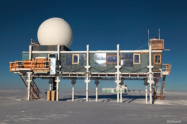
 Summit Station (Credits: Ed Stockard) |
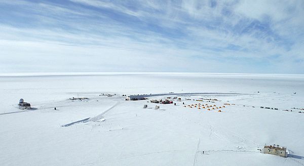 Aerial View of Summit Station (Credits: Gray Davis) |
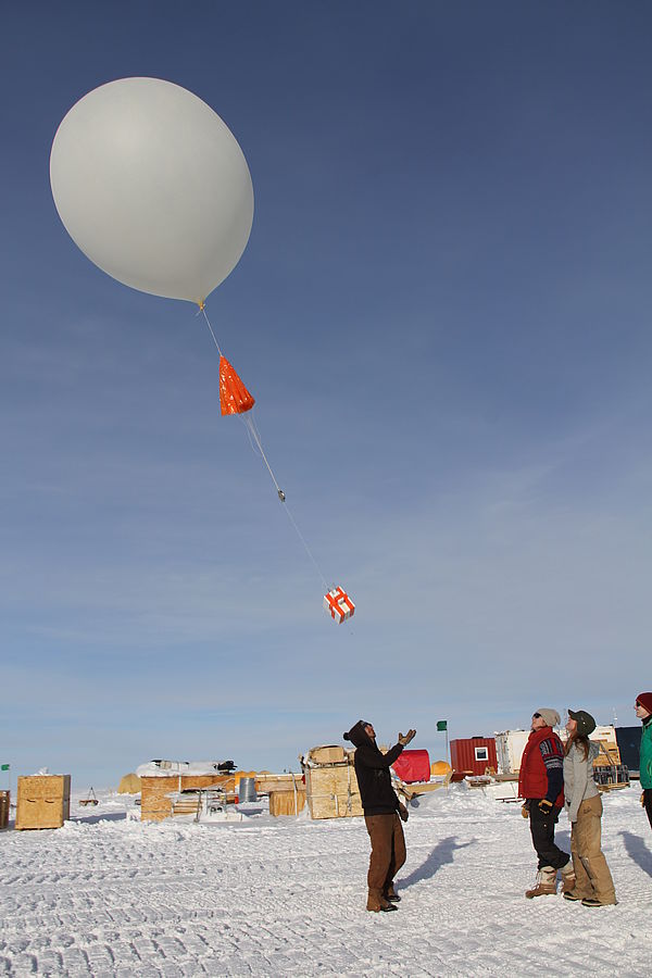 Ozone sonde (Credits: Jessy Jenkins) |
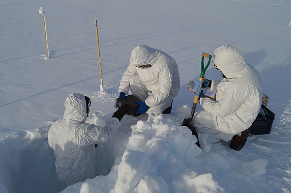 Technician Snow Sampling (Credits: Matt Okraszewski) |
 Summit Big House (Credits: Matt Okraszewski) |
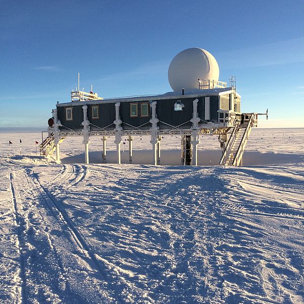
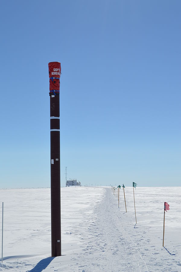 GISP2 and TAWO (Credits: Matt Okraszewski) |
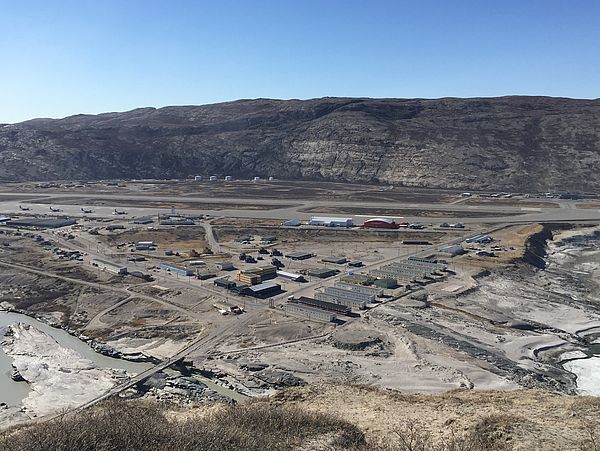 Kangerlussuaq Logstics (Credits: Renee Crain) |
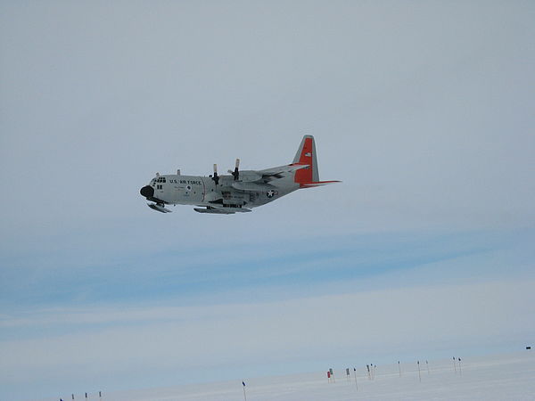 LC-130 Support Summit (Credits: Renee Crain) |
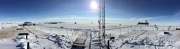 Panoramic View of Summit (Credits: Matt Okraszewski) |
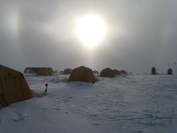 Sleeping Tents (Credits: Renee Crain) |
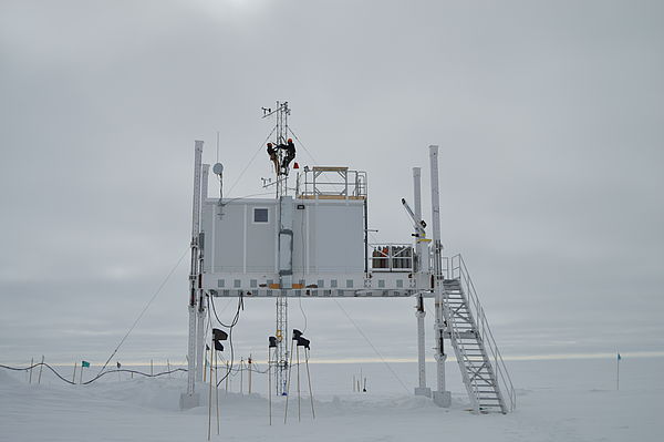 Temporary Atmospheric Watch Observatory (TAWO). (Credits: Matt Okraszewski) |