Background
IN1401 | |
Faroe Islands Nature Investigation (FINI) | |
Sub-Arctic | |
Open | |
Station | |
Faroe Islands | |
Station | |
1999 | |
Year-Round |
Introduction
The Faroe Islands Nature Investigation (FINI) belongs to Jarðfeingi (Faroese Geological Survey) and partners. | |
FINI comprises a growing number of monitoring sites placed on public and private land in the Faroe Islands. The 18 islands form a self-governing country under the sovereignty of the Kingdom of Denmark. The total area is approximately 1400 km2 and has a population of almost 50000 people (2010). The monitoring sites are placed on mountain slopes and summits that are accessible within an hour hike from the road and within an hour drive by car from the capital Tórshavn. | |
The Faroe Islands are a group of islands situated between the Norwegian Sea and the northeast Atlantic Ocean with more than 300 km distance to the next land area (approximately half way between Scotland and Iceland). The highlands of the islands have an oceanic subarctic climate. The high relief landscapes are heavily grazed by sheep. The floral and faunal biodiversity is low, reflecting the isolated location, the extreme oceanic climate, the steep topography, and intensive land use. The most dominant vegetation in the Faroe Islands is grassland, found from sea level to the mountain tops. Racomitrium heaths and fell-field vegetation dominate the alpine vegetation. Calluna heaths are common in the lowlands. Birds dominate the terrestrial wild life. | |
Most of the monitoring sites of FINI are less than 10 years old. FINI has no station facilities at the sites, but can offer office facilities including internet access, other logistic support, and advice at FINI, Jarðfeingi, in Tórshavn. | |
The research at the FINI sites focuses on geohazards, meteorology, geophysics, and plant ecology. The existing database includes a bibliography of publications based on monitoring data. | |
People in towns and villages live a modern European life. Houses are modern, the infrastructure is well developed and it is easy to travel by car. At the same time rich elements of traditional Faroese culture are deeply rooted in daily life: fishing, bird and whale hunting, traditional food and singing, and chain dancing. The language is Faroese which has close roots in the Old Norse language. | |
You can arrive to the Faroe Islands all year by ship or by plane. The ferry leaves from Hanstholm, Denmark and Seyðisfjørður, Iceland. Look for www.smyrilline.com. Flight connections to the Faroe Islands leave from Copenhagen (Denmark), Billund (Denmark), Edinburgh (Scotland), Reykjavik (Iceland), Bergen (Norway) and Barcelona (Spain). Look for www.atlantic.fo. The local infrastructure in the Faroe Islands is well developed with busses and ferries. It is also possible to rent cars and helicopter routes are fairly cheap. Look for www.visitfaroeislands.fo. |
Operator
Jarðfeingi and partners | |
Government | |
Jarðfeingi and partners | |
lm@jf.fo |
Data Source
Partner Institution
Yes | |
Søvn Landsins | |
Landsverk | |
Faroe Islands | |
Umhvørvisstovan | |
Faroe Islands |
Location
IN1401 | |
62° 4' 0'' N | |
6° 58' 0'' W | |
European Arctic | |
725 | |
0 | |
880 | |
15 | |
0 | |
0 | |
0 | |
Ice-free ground |
Climate
None | |
Sub-Arctic | |
Snow and Rain | |
Rain, snow, hails | |
1284 | |
21 | |
156 | |
SW | |
01/Oct/99 | |
1.71 | |
-2 | |
8 | |
None | |
None | |
None | |
July; August; September |
Features
Mountain; Shoreline; Valley; Other | |
Steep cliffs |
Disciplines
Climatology; Climate change; Geology; Geomorphology; Geophysics and seismology; GIS; Mapping; Sedimentology; Social science; Terrestrial biology | |
Fishery; Geocryology; marine biology; oceanography; microbiology |
Human Activities
Yes | |
Yes | |
Yes | |
No | |
Yes |
Infrastructure
IN1401 | |
100 | |
30 | |
Geology; GIS | |
0 | |
50 | |
0 | |
Yes | |
No | |
Renewable | |
220 | |
24 |
Staff Capacity
1 | |
10 | |
1 | |
10 | |
16 | |
0 |
Scientific Equipment
Logistical scientific services |
Medical Facilities
No | |
0 | |
0 | |
15 | |
0 | |
0 | |
0 | |
15 | |
No | |
No |
Vehicles
Car, bus (not at the station) |
Workshop facilities
ICTS (Staff available to assit with constructions) |
Communications
Computer; E-mail; Fax; Internet; Printer; Scanner; Telephone; VHF |
Access
IN1401 | |
Air; Sea |
Aircraft landing facilities
1 | |
0 | |
0 | |
Yes |
Transport and freight
Airplane; Ship | |
0 | |
0 |
Access To The Facility
No | |
Yes | |
lm@jf.fo |
Pictures
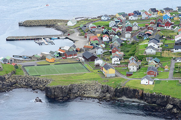
 FINI Settlement (Credits: Lis Mortensen) |
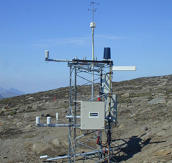 Sornfelli measuring station (Credits: Lis Mortensen) |
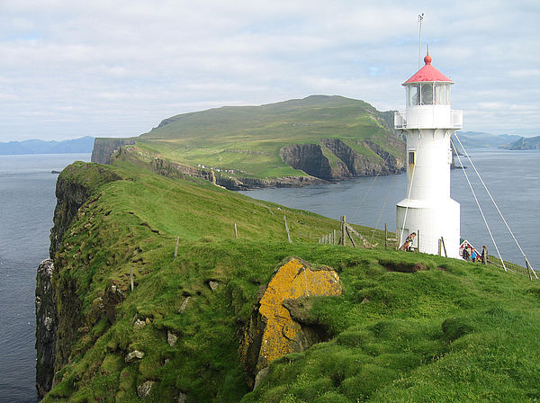 Lighthouse on island (Credits: Lis Mortensen) |
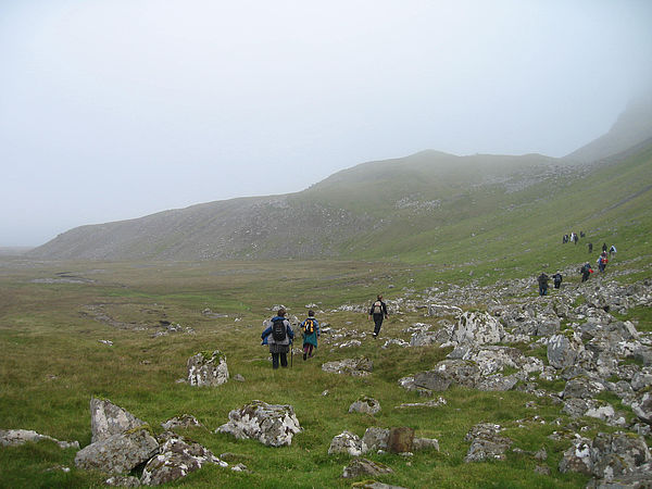 Field Excursion (Credits: Lis Mortensen) |
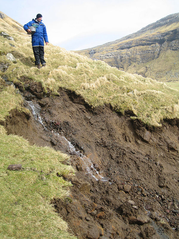 Hill side errosion (Credits: Lis Mortensen) |
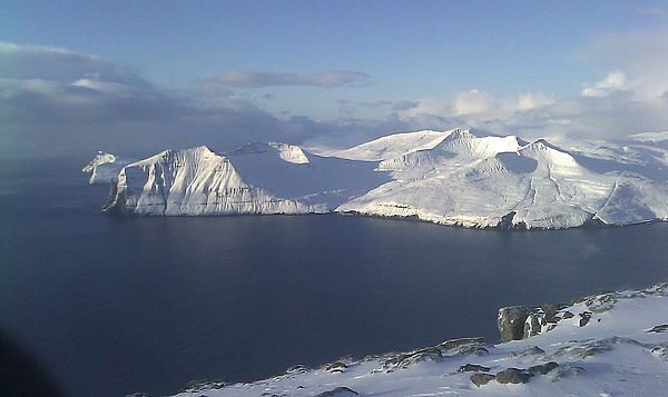 Island in winter (Credits: Lis Mortensen) |
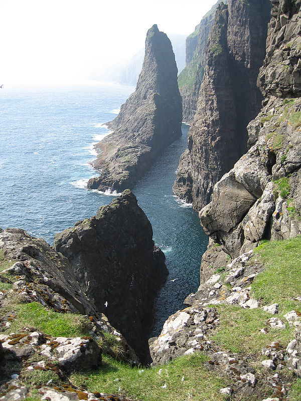 Mountain split (Credits: Lis Mortensen) |
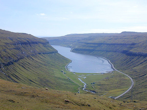 U-shaped Kaldbaksfjord (Credits: Lis Mortensen) |